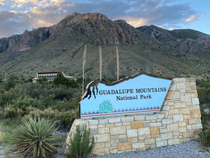
Overview
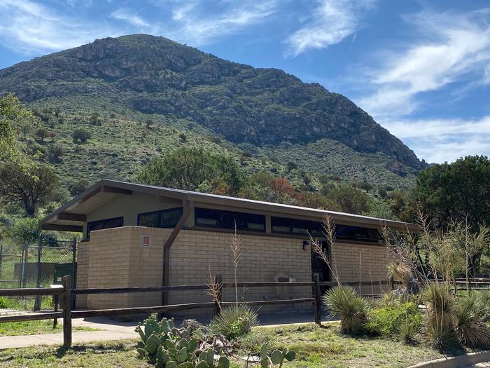
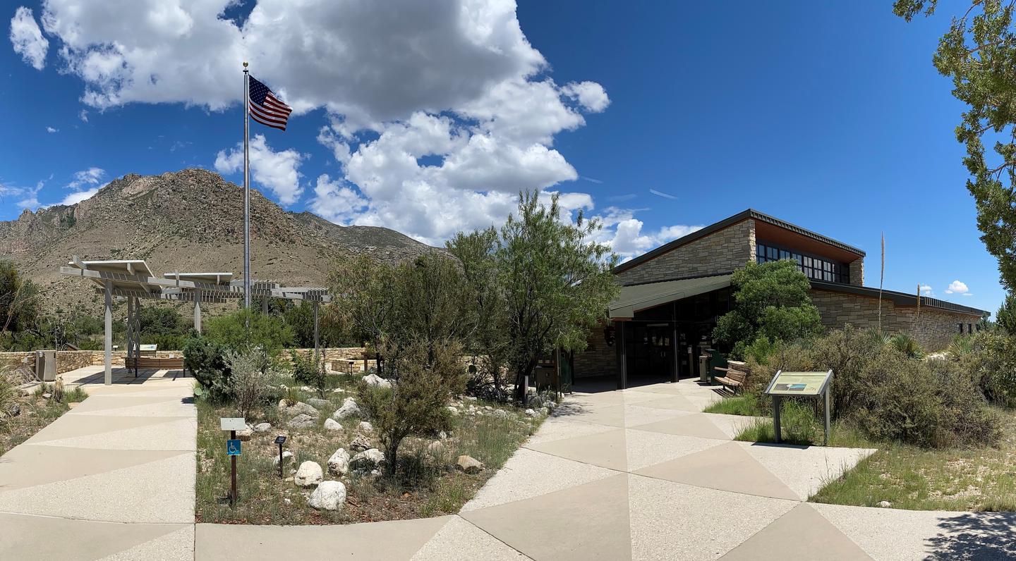
Great Facilities and Amenities
Checkin Time
(34 of 35 campsites have Checkin Time)
Checkout Time
(All campsites have Checkout Time)
Driveway Entry
(There are variety of Driveway Entry. Such as pull through and back in.)
Hike In Distance To Site
(Up to 277')
Max Num Of People
(Up to 20)
Max Num Of Vehicles
(Up to 3)
Pets Allowed
(All campsites have Pets Allowed)
Picnic Table
(29 of 35 campsites have Picnic Table)
Shade
(12 of 35 campsites have Shade)
Site Access
(Majority of the campsites have hike in)
Natural Features


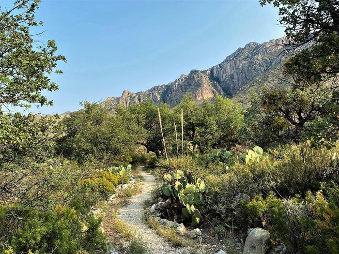
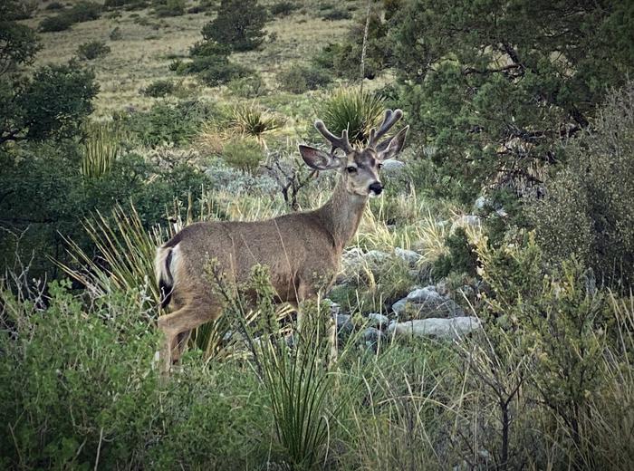
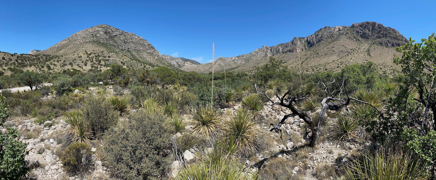
- The Pine Springs Campground is in an area with small, scattered trees, shrubs, and grasses. Trees include gray oaks and alligator junipers, which cast partial shade at some sites. Texas madrones, bigtooth maples, chinquapin oaks, and ponderosa pines become more common along the canyon floor. Higher elevations include Douglas fir and hop-hornbeam. Shrubs include whitethorn acacia, Mexican orange, Apache plume, sumacs, and algerita. Desert-adapted plants also occur in this area, and include prickly pear cactus, New Mexico agave, sotols, and soaptree yuccas.
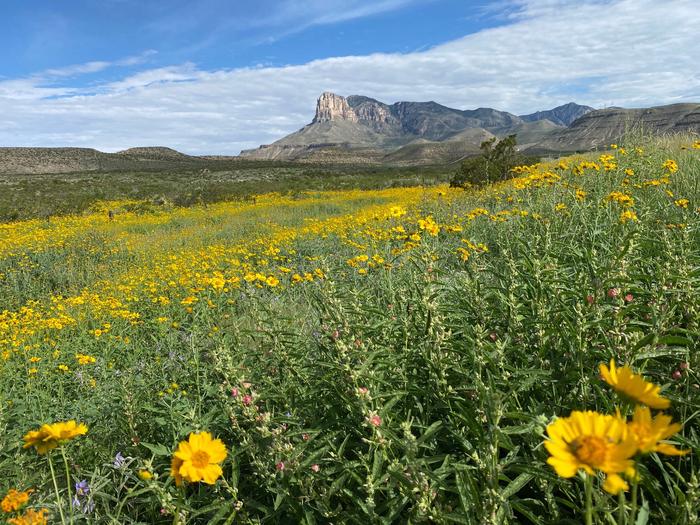
- Hunter Peak and cross-sectional views of the Capitan reef are visible from the campground. Roadside pullouts (one mile and four miles away) provide excellent views of El Capitan. Hiking into Pine Springs canyon or along the foothills reveals Guadalupe Peak. The Guadalupe Peak trail ascends to the highest point in Texas and offers excellent views of the surrounding desert.
- Birds commonly seen and/or heard around the campground can include Canyon towhees, turkey vultures, white-winged doves, common ravens, chipping sparrows, Say’s phoebes, common poorwills, and phainopeplas depending on the season.
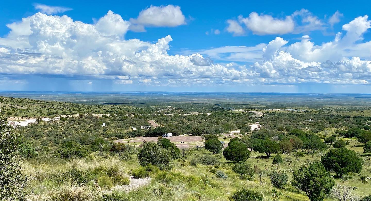
- Night sky visibility is excellent and nearly pristine directly overhead, to the south, and the southwest. Nearby high ridges and peaks are situated to the west and north.
Recreation

- The Pine Springs Trailhead includes access to many different types of hikes. Hikes to Guadalupe Peak or the Bowl are strenuous, 8-9 miles, and have 2500-3000 feet of elevation gain. Another strenuous hike is the Devil’s Hall Trail (4.2 miles round-trip, 500 feet elevation gain, ½ of the trail in a rocky, uneven wash which includes route-finding and boldering skills). For a more moderate hike consider the the Frijole/Foothills Trail. The El Capitan Trail offers excellent open views of the surrounding desert and close approaches to the cliff face of El Capitan. Because of its distance, lack of shade, some primitive route travel, and numerous elevation changes, this trail is best saved for cooler times of year and for people with experience in route-finding.
- The ruins of a Butterfield stage station, called the Pinery are next to the highway, and a short, paved nature trail connects the visitor center and the historic site.
- The Frijole Ranch & History Museum is 1.5 miles away. The grounds are always open, but the museum is staffed intermittently.
- Seven miles to the east on Hwy 62/180 is McKittrick Canyon. This area offers three trails, the McKittrick Canyon Nature Trail (0.9 miles loop), McKittrick Canyon Trail (4.8 miles round-trip to Pratt Cabin or 6.8 miles round-trip to the Grotto) and the Permian Reef Trail (8.4 miles round-trip, for serious geology buffs).
Permitted Equipment
tent-N/A
rv-Up to 50ft
trailer-Up to 50ft
5th wheel-Up to 50ft
camper van-Up to 50ft
pickup camper-Up to 50ft
pop up camper-Up to 50ft
vehicle-Up to 22ft
Nearby Attractions
Carlsbad Caverns National Park: In addition to a variety of cave tours, the national park also offers hiking trails and a scenic drive. Rattlesnake Springs and Slaughter Canyon, part of Carlsbad Caverns are nearer attractions for day use activities. Birding is excellent at Rattlesnake Springs.
Lincoln National Forest: The Guadalupe District of the Lincoln National Forest is located just over the state line, north of the national park. Road access is through New Mexico, north of White’s City, via Dark Canyon Road to NM SR 137 through Queen (also the way to the national park’s Dog Canyon). The forest provides for various camping, hiking, caving, hunting, and picnicking opportunities. Sitting Bull Falls is a nice waterfall and picnic area in the Lincoln National Forest. Five Point Vista is a glorious ridge road ride of the area, closer to Dog Canyon.
Fort Davis National Historic Site and State Park: Fort Davis is one of the best surviving examples of an Indian Wars' frontier military post in the Southwest. From 1854 to 1891, Fort Davis was strategically located to protect emigrants, mail coaches, and freight wagons on the Trans-Pecos portion of the San Antonio-El Paso Road and on the Chihuahua Trail. This is located about 2.5 hours south of the park. A state park is located nearby with camping and a scenic drive. Also located in Fort Davis is McDonald Observatory with several programs available.
White Sands National Park: Rising from the heart of the Tularosa Basin is one of the world's great natural wonders - the glistening white sands of New Mexico. Great wave-like dunes of gypsum sand have engulfed 275 square miles of desert, creating the world's largest gypsum dunefield. White Sands National Park preserves a major portion of this unique dunefield, along with the plants and animals that live here.
Hueco Tanks State Park & Historic Site: Hueco Tanks State Park is located on the east side of El Paso, about an hour and a half from the Guadalupes. At Hueco Tanks, you can hike, rock climb, bird watch, study nature and history, picnic and stargaze. Visitors can take guided and self-guided tours to view rock imagery.